

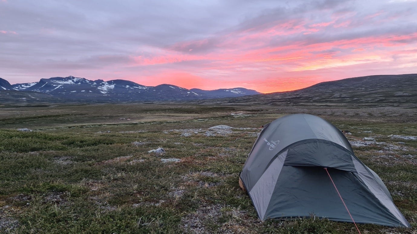
This article is going to be a bit longer and more technical than usual, so if that's not for you, I hope you still enjoy my pictures of the stunning landscape of the Swedish Mountains. Join me as I have a look at the Sylarna deposit.
As some of you might know, I am personally exploring in Sweden and Norway through a few different ventures. While I don’t have decades of experience, I am, rightfully or wrongfully, quite firmly convinced of the quality of my ideas from both a business and geological point of view.
Most ideas come up when I’m scrolling through old datasets or after hours of staring at geological maps. It usually takes quite a while for something to catch my eye, and more often than not, I move on to the next idea after only a few minutes. Every now and then, however, I stumble across a prospect that keeps my attention for a while longer. If the idea survives some more in-depth due diligence and ticks some important boxes, I usually try to visit the project and examine the historic drill core (if available).
Of around a dozen projects that I have examined in more detail over the past few years, only two made it to the next stage where I invested some of my own money to advance them further. Maybe I’ll share more about at least one of them a bit further down the line. It would surely make for an interesting read…
Sometimes, it’s an easy call to drop an idea after having seen everything in the field. In most cases, however, the reasons for not staking a project are more subtle in nature and can range from limited time or personal preferences to funding possibilities.
In other words, if I don’t go ahead with a specific project, the idea might, directly or indirectly, still hold significant value for others.
Instead of sitting on those ideas, I thought it would be more fun to put them up for public scrutiny. Besides hopefully gaining a subscriber or two, the feedback I receive from this community might prove more valuable than keeping it all for myself. I also like the idea that my ramblings might push someone else’s thinking a bit further, potentially leading them to find something great.
So without further ado, join me on an “expedition” to a forgotten copper prospect that appears to belong to a deposit class that has not previously been recognized in Sweden (or has it?) but could be hidden in a large part of the country’s bedrock.
Styles of copper mineralization in Sweden
Sweden is home to almost all known styles of copper mineralization. The country is host to classical VMS deposits, mafic-ultramafic intrusions, skarns, IOCG-like occurrences, SEDEX-style mineralization, porphyries, and even sedimentary-hosted copper deposits.
A while ago, I started to learn more about the latter. While the supergiant examples of Poland and Central Africa are generally hosted by sedimentary rocks (who would have guessed that..), there exists a lesser-known subclass, historically referred to as volcanic-hosted or volcanic redbed copper deposits. Going forward I’ll be referring to them as VRCs and to the sedimentary-hosted variant as SSCs.
So what are VRCs? 🌋
Since VRCs have to date not been of major interest to the mining industry, there doesn’t seem to exist the same amount of research as for example for VMS deposits or porphyries.
From what is known, these deposits appear, in many regards, very similar to their sedimentary-hosted counterparts. The ore is generally of disseminated and/or fissure fill nature with grades generally ranging from 0.7% to 5% Cu (see grade tonnage curve below). The deposits are generally stratabound and can sometimes be of significant lateral extent, although not as continuous as for example the classical reduced type sedimentary copper deposits in Poland and Germany. Akin to sedimentary copper deposits, at least some VRCs appear to show a mineral zonation from pyrite to chalcopyrite and bornite in the outer margins to chalcocite and native copper in the center of the deposit. The most common host rock appears to be mafic volcanic, most often, subaerial basalts. Mineralization appears to form in diagenetic to low-grade metamorphic setting, similar to the classical SSC system that are also known to occur in close spatial relation to VRCs.
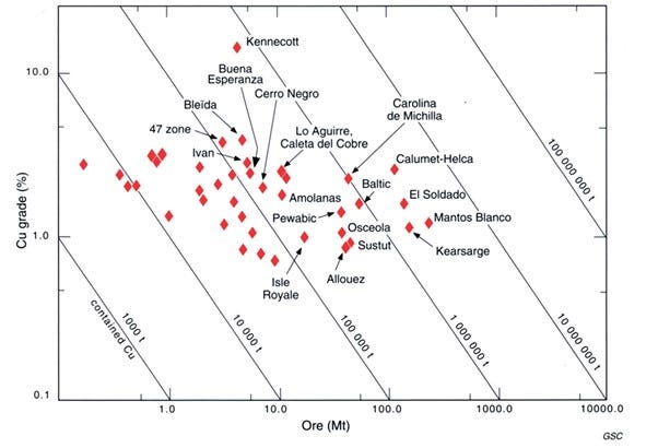
Compared to SSC deposits, VRCs appear to have fewer valuable byproducts, the likes of Co, Au, or Ag, with copper in most cases being the sole metal of economic importance. They also seem to be at least an order of magnitude smaller than SSC deposits, with the amount of contained copper in VRCs rarely exceeding 1 Mt.
That is, however, not an insignificant amount and could make these deposits an interesting target as the world is scrambling to add to its depleting copper reserves.
VRCs: a solution to the looming copper shortage? 📉
To this day, VRC’s have not been of strong interest to the mining industry. I assume that, in ancient times, massive sulfide deposits were a preferable copper source due to their generally higher grade and inferred easier processing. Post-industrial revolution, the problem for VRC’s was probably their limited size, compared to enormous porphyry deposits that also had much higher grades back in those days.
With diminishing copper grades in the world’s porphyry deposits, not enough SSCs available to fill the gap, the permitting issues for supergiant low-grade mines and an expected rise in copper prices, VRCs might suddenly become much more interesting.
On a regional scale 🗺️
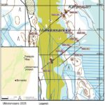
With all that in mind, let’s now turn our attention back to Sweden, and in more detail to an old prospect in the mountains near the Norwegian border.
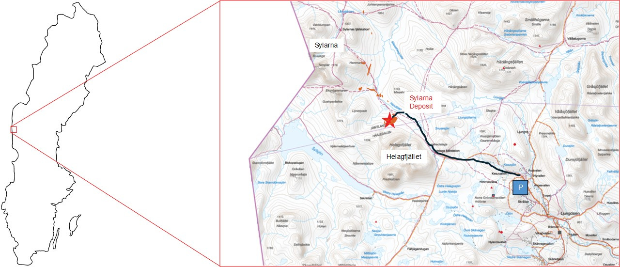
Located in Jämtland county, in a scenic setting above the tree line between the Helag and Sylarna mountain ranges, the Sylarna deposit is hosted by a part of the Scandinavian Caledonites, commonly referred to as the Seve Nappe. Seve Nappe rocks generally consist of locally high-grade metamorphosed mafic volcanic and former sedimentary rocks and are believed to originate from the outermost passive margin of Baltica (an ancient continent) that was thrust over the Paleoproterozoic basement during the closure of the Iapetus Ocean some 400 million years ago.
It is within these mafic volcanic and sedimentary rocks of the Seve Nappe, that copper mineralization was discovered in the 1970’s. Although I might be on the wrong path here, to me, this style of mineralization most closely resembles to what is described in literature as VRC.
How to get there 🚶♂️
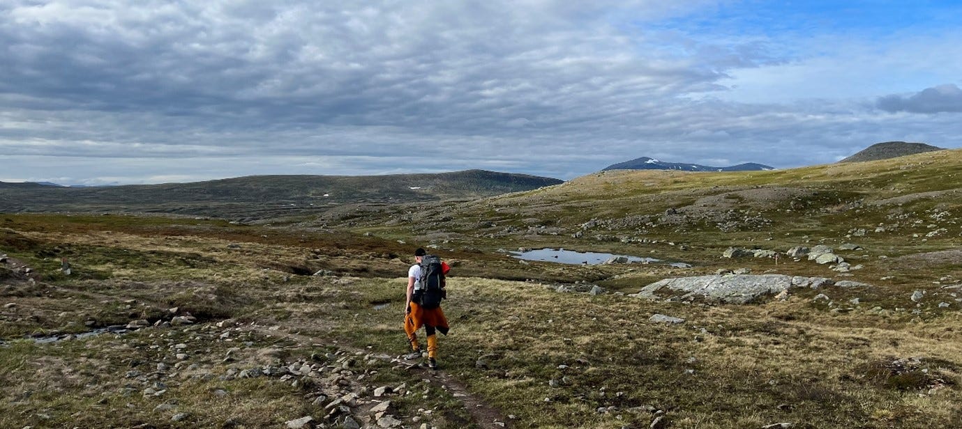
While the Sylarna deposit is located off-grid for Swedish standards (usually, there exists at least a logging road within a few kilometers of any prospect), it is still somewhat accessible as it is located only a few hundred meters south of a popular hiking trail. The best way to access the area is by parking at the entrance of Kesu Valley and then following the trail to the Helag Mountain Station, before switching lanes to the even more remote Sylarna Mountain Station. It’s an easy trail but a rather long walk of almost 20 km. After a few miserable kilometers through a mosquito-infested forest, one is rewarded rather quickly with the stunning beauty of the Swedish mountains.
Who found it and when? 🔎
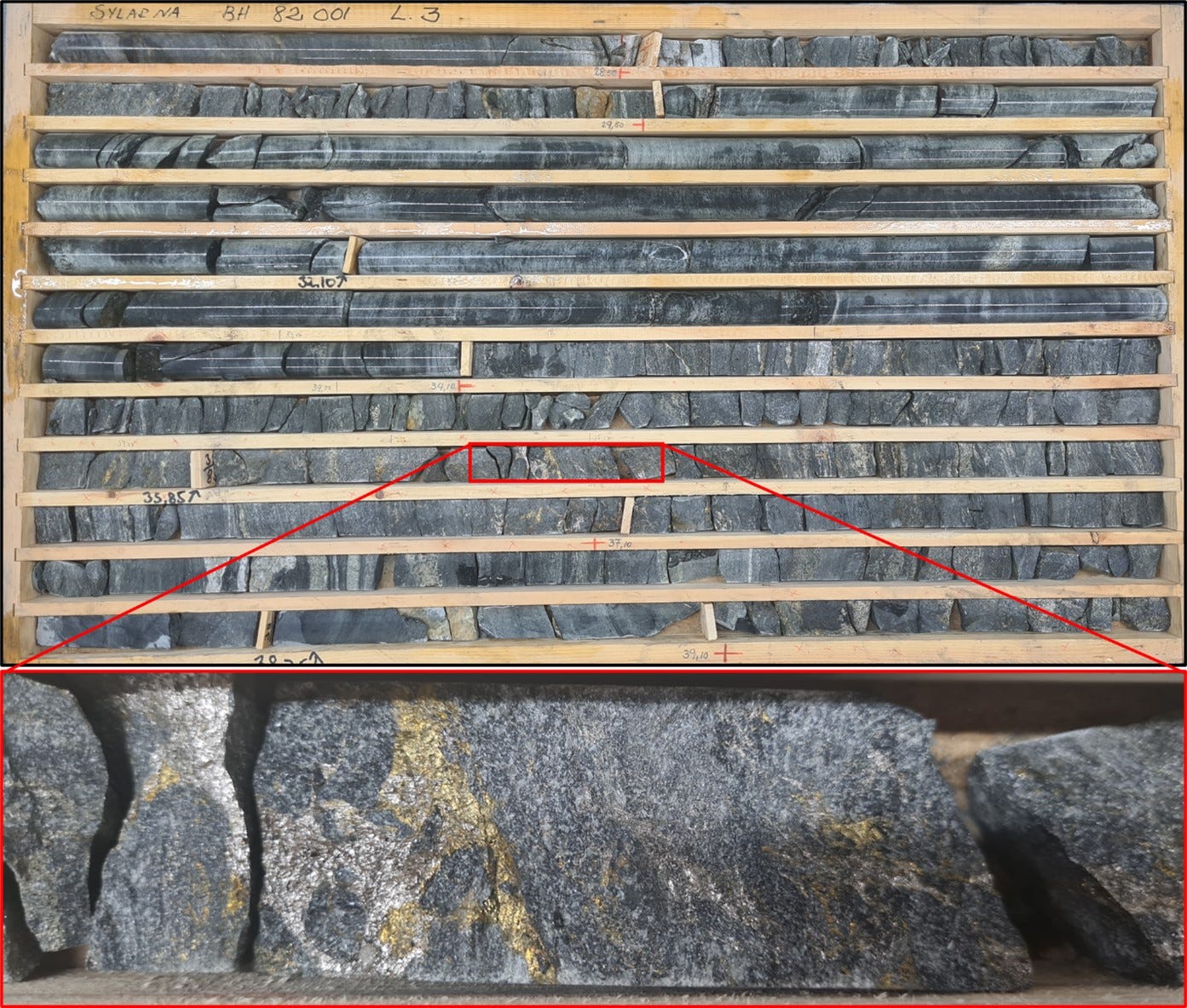
The original discovery of the deposit dates back to the early 70s when initial prospecting by the Swedish Geological Survey uncovered copper mineralized boulders and outcrops between the Sylarna and Helag mountain ranges. Subsequent stream sediment sampling, magnetometer, and slingram (an old type of EM measurements) surveys resulted in the definition of multiple anomalies, of which the most interesting prospect, creatively named Sylarna, was tested with an initial four drill holes in 1977, returning up to 19.4m @ 0.42% Cu. Based on the promising results, a six-drill hole, follow-up campaign was conducted in 1982, returning up to 11.5m @ 0.64% Cu in drill hole 82001 (see core picture further down).
A preliminary resource calculation based on the two drilling campaigns indicated a low grade but potentially large tonnage system with 3-10 Mt @ 0.44-0.84% Cu and good growth potential through additional drilling.
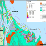
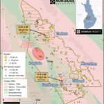
Back in the day, the idea was to potentially develop the project as a combined open pit and underground operation, supported by potentially higher-grade ore from multiple satellite deposits. The potential for satellite deposits is indicated by the occurrence of around a dozen additional slingram anomalies that have never been followed up. (marked in orange on the overview map above).
The rocks ⛰️
The geology in the area is dominated by epidote-altered amphibolites and a mix of mafic and gneissic material transitioning into more homogeneous meta-sediments towards the east. On a larger scale, the ore seems to be located at the transition between the amphibolites and overlying sediments, with the mineralization sitting in both units but favorably in the latter.
The ore mineralogy is dominated by iron sulfides with varying amounts of chalcopyrite. While chalcopyrite represents the main ore mineral, thin section analysis has shown chalcocite and native copper to occur as accessories.
When it comes to the structures of the deposit, the initial observation of bedding parallel foliation, together with some folding indications from the slingram anomalies had previous geologists think of a flat lying isoclinal fold. While I couldn’t confirm any of this in the field a brief Leapfrog exercise somewhat supports such an idea.
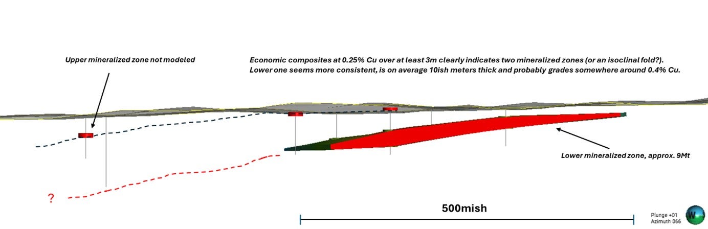
Running some quick economic composites, you’ll end up with two distinct zones of higher-grade material dipping very shallow to the northwest. While I only modeled the lower mineralized zone (red body above), you can still see the “ore” intervals of the upper mineralized zone (red disks), that would, if modeled, represent a subparallel body that could represent the other limb of a flat lying isoclinal fold.
Whether isoclinal fold or multiple, possibly stacked horizons, the modeling exercise indicates that drilling in the northwest did not go deep enough, potentially missing the continuation of the lower mineralized zone.
Based on eyeballing the average copper grades from the economic composites in the lower mineralized zone and the volume of my model I ended up somewhere around 9Mt @ 0.4% Cu, which seems to fit quite well with the historic estimates.
A deposit with a view 🌄
When reaching the site of the deposit, I started to wonder if it would still be possible to see the collars, having only approximate coordinates. After all, almost 50 years have passed since the first holes were drilled.
Upon closing in on the coordinates of the first drill hole, I could see an approximately 3m long pole sticking out of the landscape. Assuming it was some kind of fence post, I ignored it, turned around, and, by happenstance, stumbled over another drill hole. The drill site was a bit messy, with quite a bit of metal still lying around after almost 50 years.

After seeing that drill hole, it dawned on me that my fence post was actually another one that for some reason has been left with a 3m long collar. After looking at the old reports again, I realized that drilling must have happened during winter, with the hole being collared from a several-meter thick blanket of ice and snow.
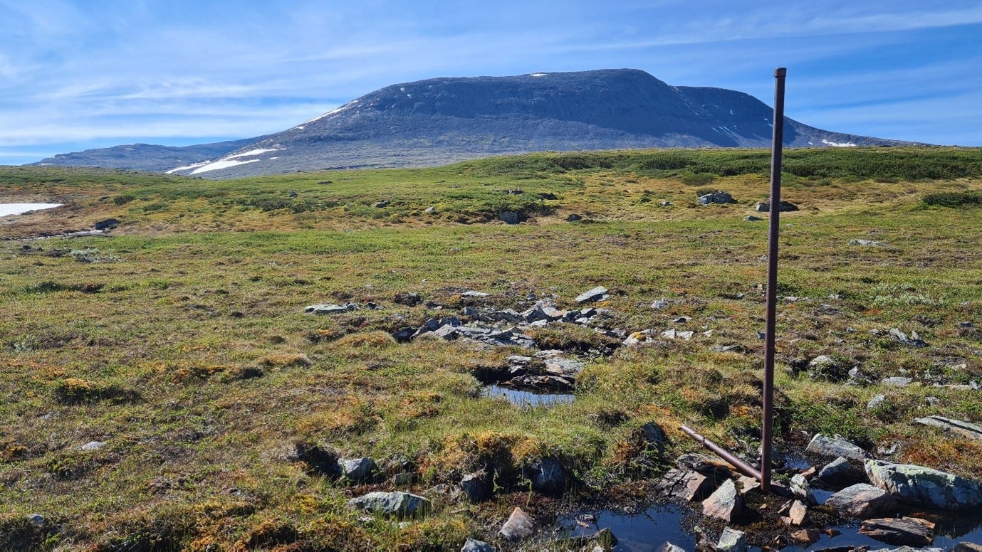
With that in mind, I suddenly started to see drill holes sticking out all over the place. At least four of them can be seen poking the deposit on the picture below (marked with red arrows). It would be good if someone eventually goes and cuts them off, as they look like they will still be around in 200 years from now.
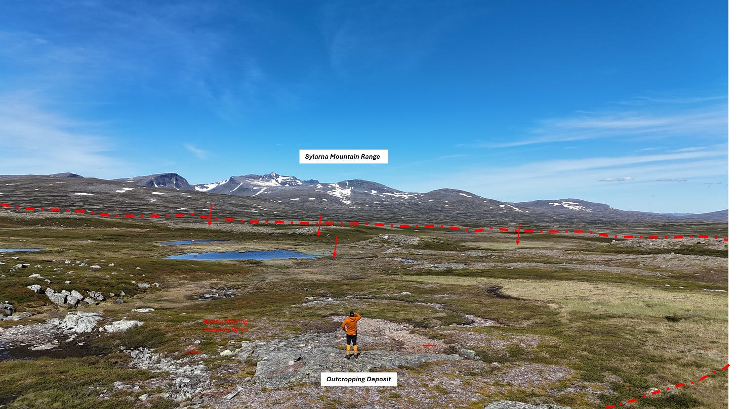
The outcropping parts of the deposit 🛠️
After having found the collars, I wanted to check out the outcropping mineralization itself. The mineralized outcrops I visited consisted mostly of rusty amphibolites and some undefined sediments with locally visible epidote alteration. Some banding with a shallow dip to the NW is visible in both lithologies. While this is rather likely to represent bedding in the meta sediments, the textures origin in the amphibolites remains ambiguous.
Locally, the otherwise disseminated mineralization becomes almost massive (is that what they saw with the slingram?), but appeared to be dominated by pyrite and pyrrhotite with only minor amounts of copper here and there.
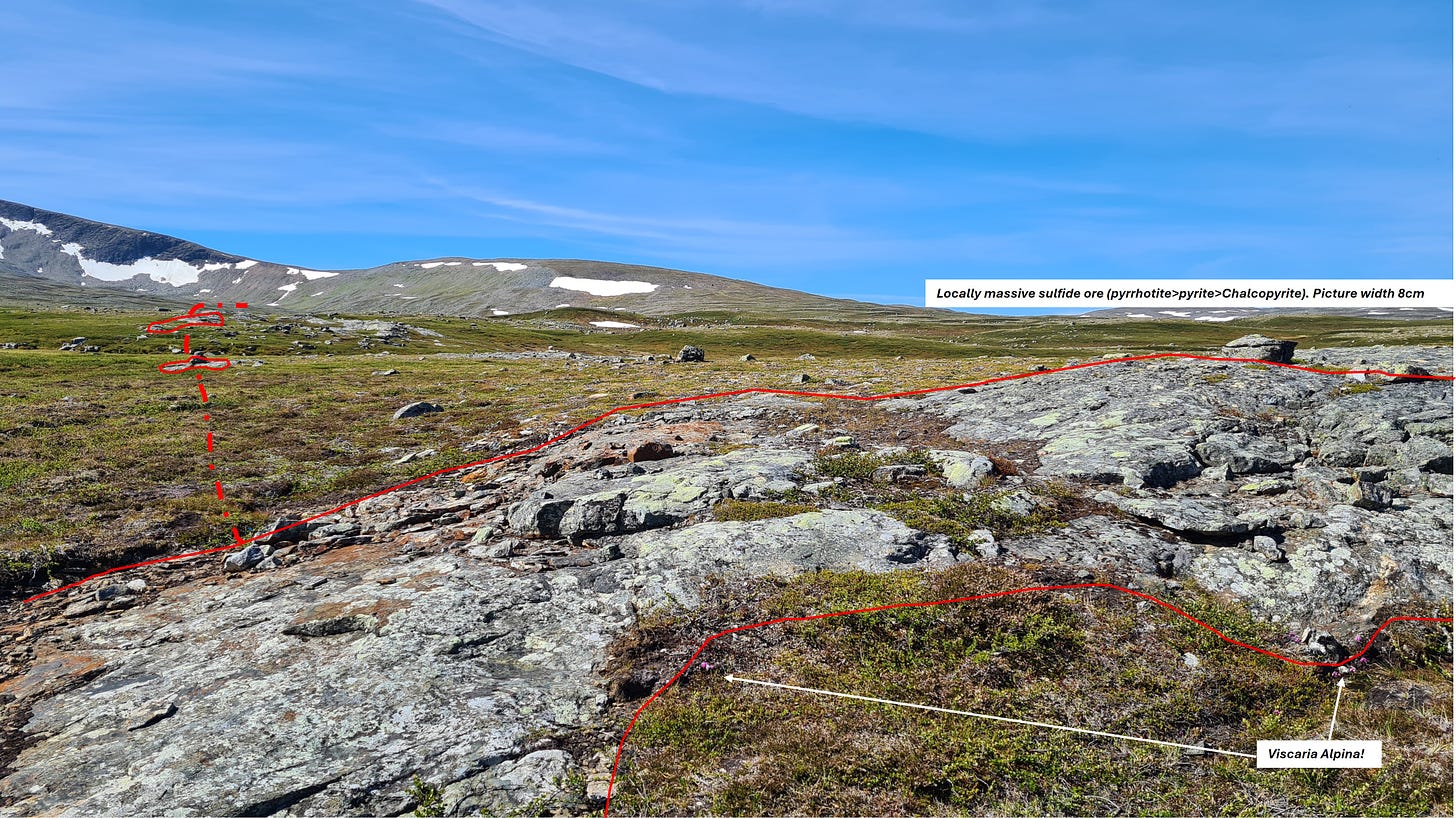
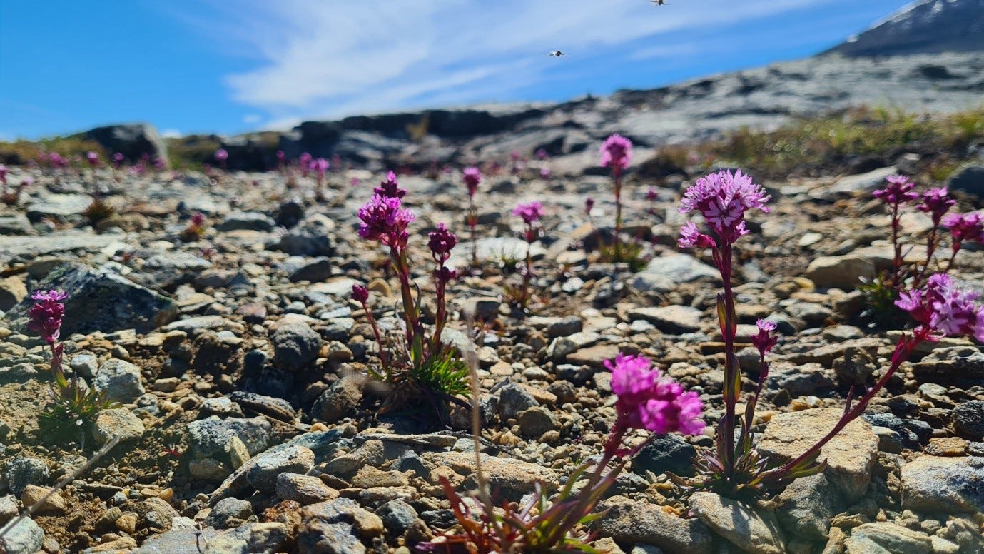
Geobotanical prospecting actually works! 🌸
While walking around the outcropping deposit and trying to understand its geometry I started to see something else that came a bit as a nice surprise. When working in the exploration industry in Sweden, you will eventually hear about how the Viscaria deposit was discovered through the selective occurrence of Viscaria alpina, a plant that thrives especially well in copper-enriched soils. If I am honest, I have been disregarding this so far as a fairy tale, but what I’ve seen at Sylarna made me change my mind. The little purple plant is growing around every mineralized outcrop (picture above) or in some gullies originating from the copper-bearing rocks (picture below).
I’ll definitely keep an eye on this plant in the future…
The core 🛠️
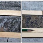
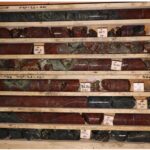
I also had a (albeit very brief) look at some of the existing core in Malå, where most of Sweden’s drill core is stored. It looked like not all of the holes are preserved, but the ones that exist are in good condition. Unfortunately, the core has been split, rather than cut, which was common back in the day (making it more challenging to log the rocks). The holes I’ve seen were mostly meta-sediments, with locally even some calcareous parts. Mineralization seemed to locally follow the bedding planes but more often than not appeared to be some sort of small crack and fissure fill. The picture below shows some pyrrhotite-chalcopyrite mineralization in drill hole 82001 which returned 11.5m @ 0.64% Cu, including 3m @ 0.91% Cu and 2m @ 0.88% Cu.
A good prospect or not? ⚖️
So after all this, why did I decide to share this with everyone? While the prospect is certainly interesting, can possibly be grown to 50 Mt at similar grades and the area has a good potential to host additional, possibly higher-grade satellite deposits (remember the old slingram anomalies), I don’t think what can be found there will be large or rich enough to actually build a mine in this rather remote part of the country. The fact that the deposit is located in a specially protected part of the mountains along a rather popular hiking trail probably won’t help with the social acceptance of a massive open pit either…
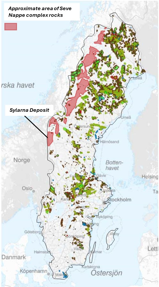
That said, I am by now quite convinced that the deposit represents some kind of a sedimentary copper system (happy to be proven wrong), most likely something that would be classified as a VRC deposit. As the rocks of the Seve Nappe are known to straddle the Norwegian border for several hundred kilometers one might want to have all look at those areas with the VRC (or even SSC?) idea in mind. 🤔
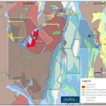
Interestingly enough, the Seve Nappe appears to be one of the largest blank spots when it comes to exploration in Sweden. I highlighted this on the map below, where I added the approximate location of Seve Nappe rocks to the geological survey’s mineral permit map (all the greenish stuff represents current and historic exploration licenses).
With that, I leave it to my colleagues to follow up on this or not. I hope I managed to push some boundaries in everyone’s thinking and if not, at least convinced you to go on a hike in the Scandinavian Caledonides.
The Northern Explorer