

Following a quite popular video from the small-scale mining and prospecting community – I was quite keen to see the Harnäs gold project in southern Sweden for myself. Join me as I try to wrap my head around the project and assess its potential. Special thanks to Daniel and Magnus for hosting, and Axel for all the geological input resulting in the first 3D model of the deposit.
Project location and history 🗺️
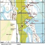
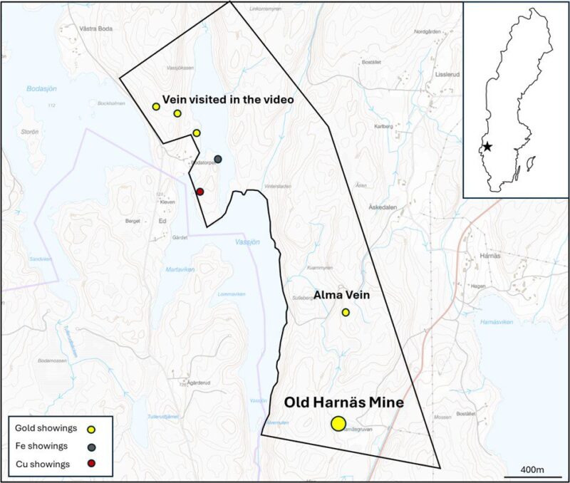
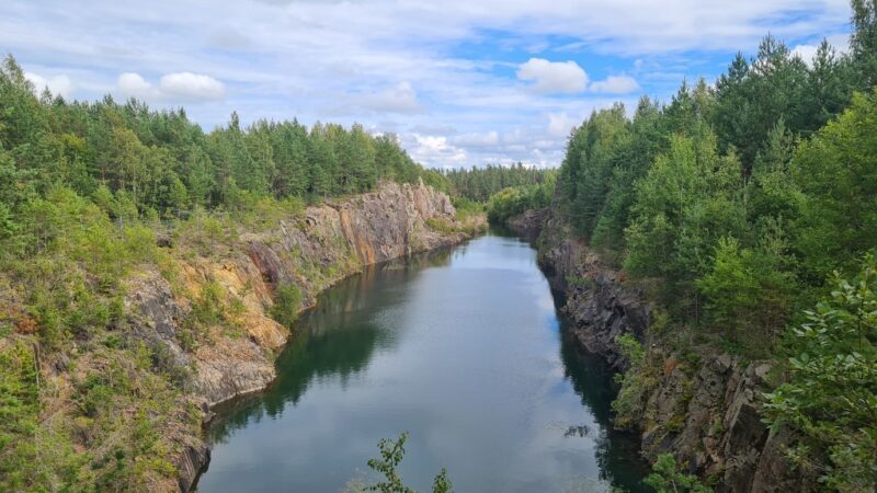
While most gold in Sweden is found in the northern part of the country, the Harnäs project is located further south, reachable via a 2.5h drive from Oslo or Gothenburg. As common for Sweden, it’s possible to drive up to the old Harnäs mine and reach most of the property via a short walk. The landscape within the permit is also rather typical – rolling hills covered in forest. While the area is outside the country’s currently active mining districts, there has been some historic mining going on – in the case of Harnäs, as recently as 1997.
Geology & History 🌋📚
Harnäs is located in the Mjøsa‐Vänern ore district, covering a larger area in the border region between southern Norway and Sweden. The district is known for its auriferous orogenic veins and has given rise to, for example the Brødstad gold mine just north of Oslo. While the host rock at Härnäs (orthogneiss) is approximately 1.6 billion years old, the gold mineralization is inferred to be of Neoproterozoic age, related to the last stages of the Sveconorwegian orogeny (around 1 billion years ago).
Gold was mined at Harnäs by Wermlands Guldbrytning AB in an open pit operation during several periods from 1993 to 1997. According to old records, some 60,000t of ore at an average grade of 2g/t Au have been processed. This includes likely some significant dilution as the ore zone is known to have higher grades but is thinner than the size of the pit suggests. As we shall soon see, the gold mineralization continues underneath the old workings and the strike extent of the system has not been sufficiently tested.
The team 👷♂️ 👷♂️
This project is a bit unusual compared to what you come across in general. It’s currently being advanced by two Swedes who are relatively new to the game with their own money, and not, as is usually the case by some geos, usually backed by cash from Australia or Canada. I’m not going to sugarcoat it – this certainly led to some unnecessary risk for the guys, but there are quite a few things that have been handled better than most of the “professionals” could do. Firstly, when picking up the project, Daniel rather quickly understood the importance of having the social license to operate. He invested significant time and resources to ensure that everyone understood how his proposed operation could benefit the local community. Now, some of the landowners are actively involved in the project. Secondly, their recent collaboration with some large YouTube channels put it on the radar of many potential investors and probably gave them more exposure than all other early-stage gold projects in the Nordics combined. They have also managed to bring on some excellent mentors to guide them along the way.
The plan 📝
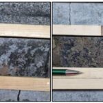
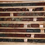
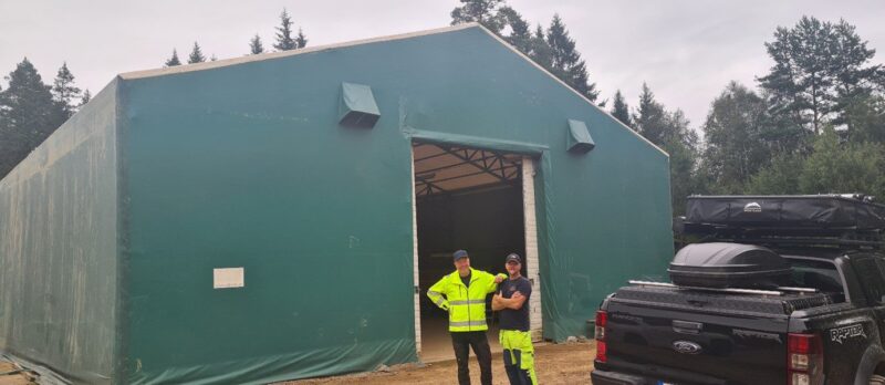
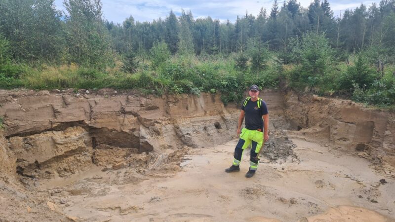
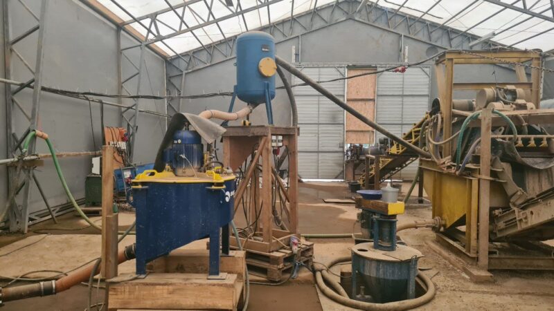
After initially picking up the project for its hard rock potential, the guys quickly realized that the old mine tailings still contained gold, representing an interesting opportunity to kickstart the project by recovering gold from the already processed material. As a result, most of their effort so far has been focused on establishing a small-scale gold recovery circuit in a newly built facility just meters away from the tailings dump, which is estimated to hold some 60,000t. The guys are currently testing material from several larger trial pits (see picture below).
In addition to the tailings, initial tests of the waste rock also returned gold, leading to the idea of investing in a crusher to reprocess this material. Since I don’t have much expertise in this type of mining, apart from what I’ve seen on Gold Rush, I’ll refrain from commenting too much on it. I’m certainly hoping this works out, and the team strikes it rich with their tailings material.
The hard rock project🛠️
Sticking to what I know best, I decided to take a more detailed look at the hard rock part of the project. After learning that some of the drilling and assay data survived, but so far has not been modeled, I couldn’t resist putting it all into Leapfrog. Following discussions with Axel who previously did some work on the project we came up with a “quick-and-dirty” 3D and exploration model that I’ll try to roughly outline below.
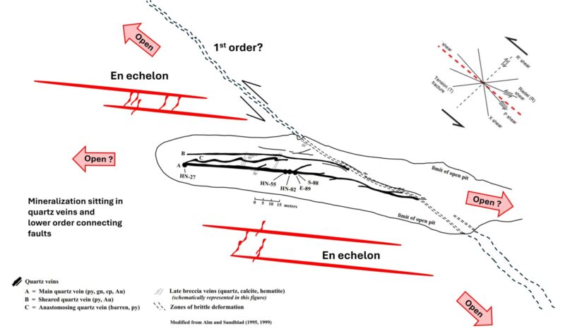
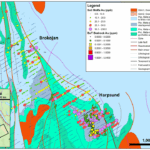
Gold at Harnäs is associated with several decimeter- to meter-wide quartz-pyrite veins, but also occurs in smaller interconnecting veinlets, brittle fracture zones, and is linked to sulfides in the wall rock. The larger veins run parallel to a prominent fault zone that can be traced several hundred meters west of the pit. Another important NW-trending structure appears to truncate the deposit in the east (dashed line in the graphic above).
While the E-W trending fault zone clearly hosts the gold, the question is how significant it is in triggering the mineralization. It cannot be ruled out that this is the controlling structure and the NW feature is simply a later development, but I, like several geologists before me, would place my bet on the NW trending structure. This interpretation fits well with historic structural observations and aligns with classical fault propagation models. By applying some left-lateral movement along the NW structure, the auriferous quartz veins can be interpreted as tension fractures or as some might call it en echelons.
If true, this suggests that the NW-striking feature outlines the more prospective trend, with good potential to host additional gold occurrences. That being said, the Harnäs vein system remains open on both sides of the pit and, along with the down-dip extension, presents an excellent walk-up drill target.
Leapfrog Model🐸
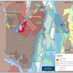
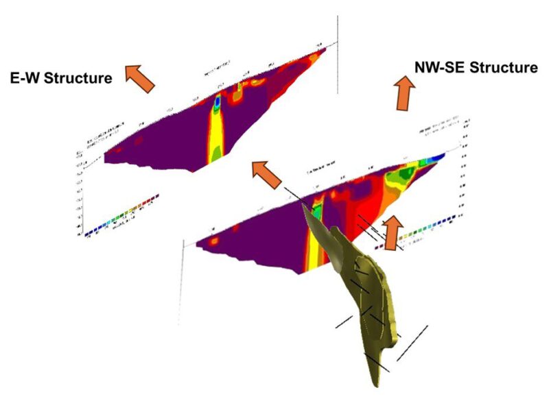
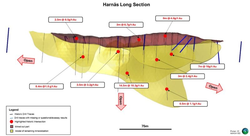
The 3D model is based on some 50 holes (20 RC and 31 diamond holes) drilled before mining commenced in the early ’90s, with most of the holes having been at least partially assayed. As seen in the long section below, the historical drilling has defined gold mineralization to at least 70 meters below the pit surface. The yellow shapes on the long section represent a first-pass model where I attempted to connect all the +1 g/t Au intercepts in a somewhat sensible way. While I couldn’t detect any plunge in 3D, previous work noted a lineation, so I modeled the largest vein with a plunge to the east.
Cutting the yellow vein shape with the actual pit surface returned approximately 14,000m3 of mined-out vein material and some 38,000m3 of vein material left in the ground. The grades remain unknown as no estimation has been performed to date. Nonetheless, it’s probably fair to assume that a minimum of 5,000 to 20,000oz still remains beneath the pit. I would say there exists a good potential to get this to 50,000 – 100,000oz with some limited drilling at depth and along strike where geophysics indicate the continuation of this structure (s). See graphic above.
In addition to the immediate brownfield potential beneath the pit and along both the E-W and NW-SE structures, the greenfield upside on that project is also pretty good, considering that the other quartz vein gold showings highlighted on the overview map seem to align with the NW corridor.
After visiting the site, meeting the guys, and modeling the old data, I’d say the hard rock project is quite promising. There is definitely potential to grow the old Harnäs mine to at least 50,000 to 100,000oz, and with a bit of luck, discover more mineralization in the wider region
For those interested in getting involved with the project, please reach out to Daniel and Magnus for business opportunities or contact Axel for more detailed geological information.
If you liked this article, you might also enjoy my site visits at Norra Kärr, Olserum & Tomtebo.
The Northern Explorer